Please note that now you can also use the tool on the Web App: www.waterspeedapp.com/webapp
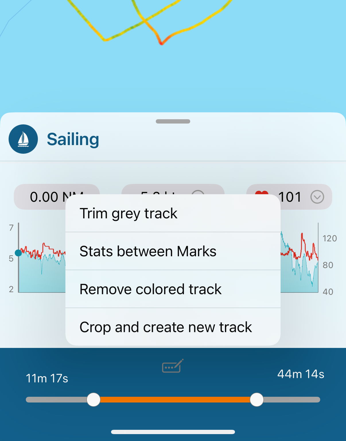
In case of errors from the GPS or if you forgot to stop when back to the land, you can use the tool "Trim/Cut/Remove/Crop track" to amend the map. Click on the icon in the right-up corner to start it.
1. Use the slider to select a portion of the track. It will color in grey the beginning and the end of it.
2. Now you can choose:
a. Trim, to remove the grey part, at the beginning and the end
b. Remove, to delete the part in the middle, with colored track
c. Crop, to create a new activity using the internal part, with the colored track
d. Calculate statistics and show on the page, using the internal part, with the colored track
More tools:
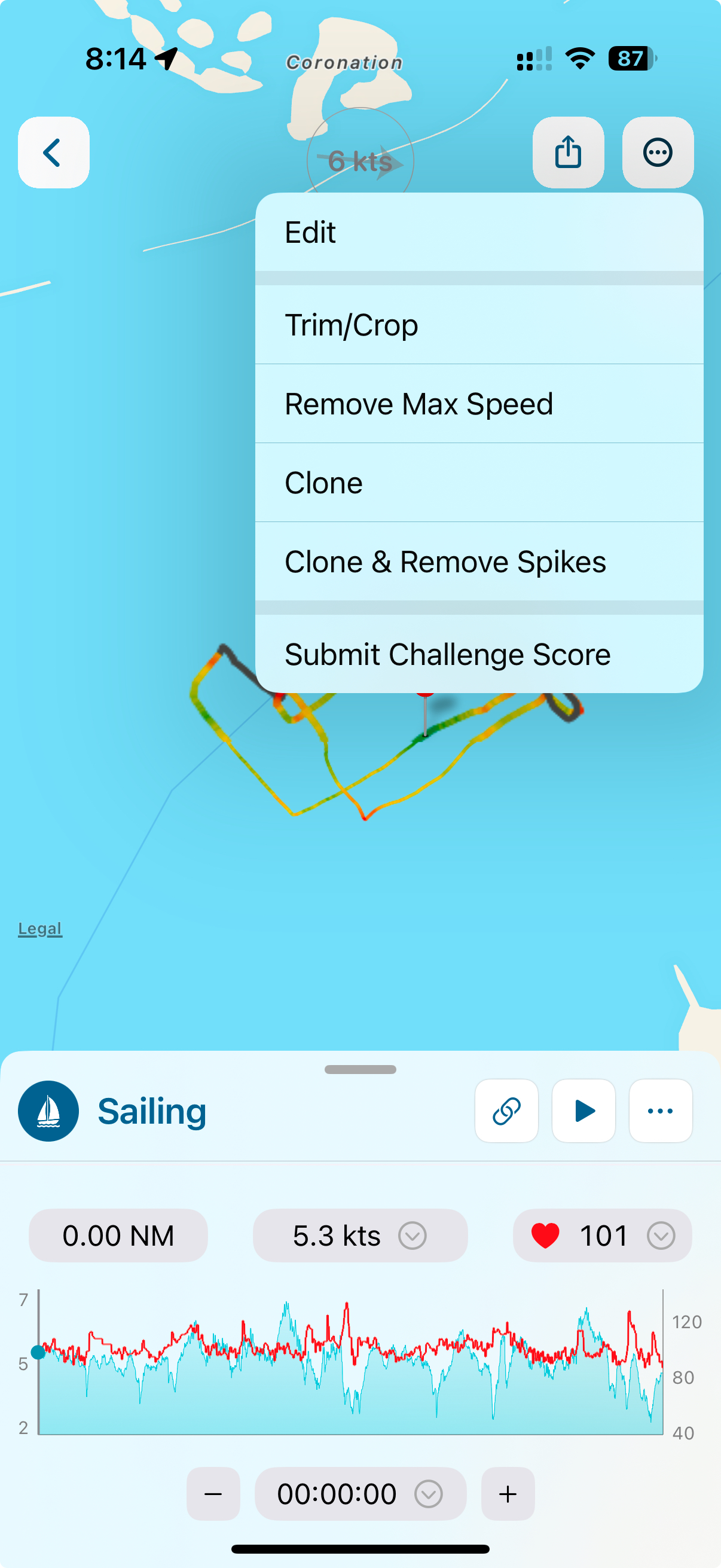
From the 3 dots menu at the top right corner, you can also:
- Remove Max speed: it will search for the point with the maximum speed and it will remove that point and 2 points before and after
- Clone: it will create a new activity duplicating the existing one
- Clone & Remove errors: it will duplicate the activity and try to remove errors, spikes, wrong GPS points